
Well we got off to an early start for a fairly short day.
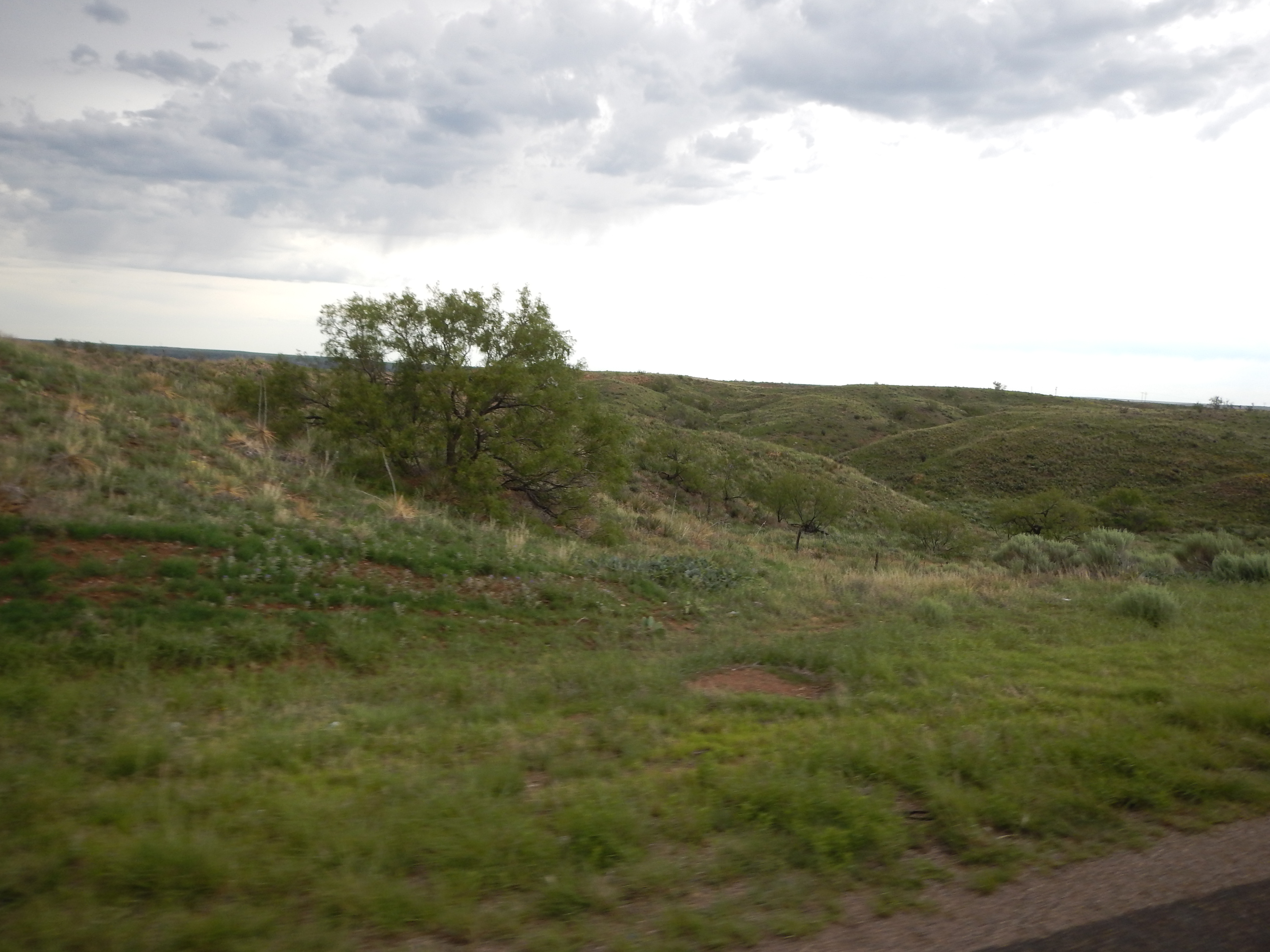
From Amarillo we went up the I-87 towards the New Mexico border, on the way we went across the Texas Panhandle, miles of rolling acres again, but not quite as desolate and flat as the journey before.
In fact the countryside looked a lot like the Derbyshire Moors of home in England, just a bigger expanse.
 .
. 
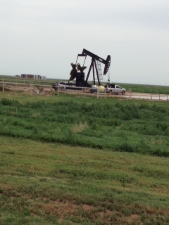
Dotted across the landscape, we saw the old ‘Nodding Donkey’ Oil Drilling Wells, a testimony to Texas early oil exploration and extraction.
Mostly they were stood still, but occasionally a group of them were still nodding away, producing oil.
 .
. 
As we moved into New Mexico, the landscape got a bit more rolling with occasional bush and even a small tree or two.
The ‘Hunter’ driver spotted a number of antelope dotted around the countryside and pointed them out to the ‘Gather’ navigator, who failed to spot a single one, despite having the eyes of an eagle when the Hunter leaves anything out of place.
After failing to spot several Antelopes that were pointed out, a loud cry of ‘You are making it up’ was heard, whereupon the Hunter protested vigorously that the Antelopes were indeed there.
Just then luck prevailed and a large group (5) was spotted by both parties and peace settled into the RV cab once more.
The whole journey was at quite a high altitude, appearing to climb steadily as we crossed New Mexico and into Colorado.
A few miles into Colorado, we turned into Trinidad State Park, beautiful scenery, with mountains and deep valleys.
 .
. 
 .
. 
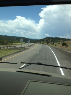
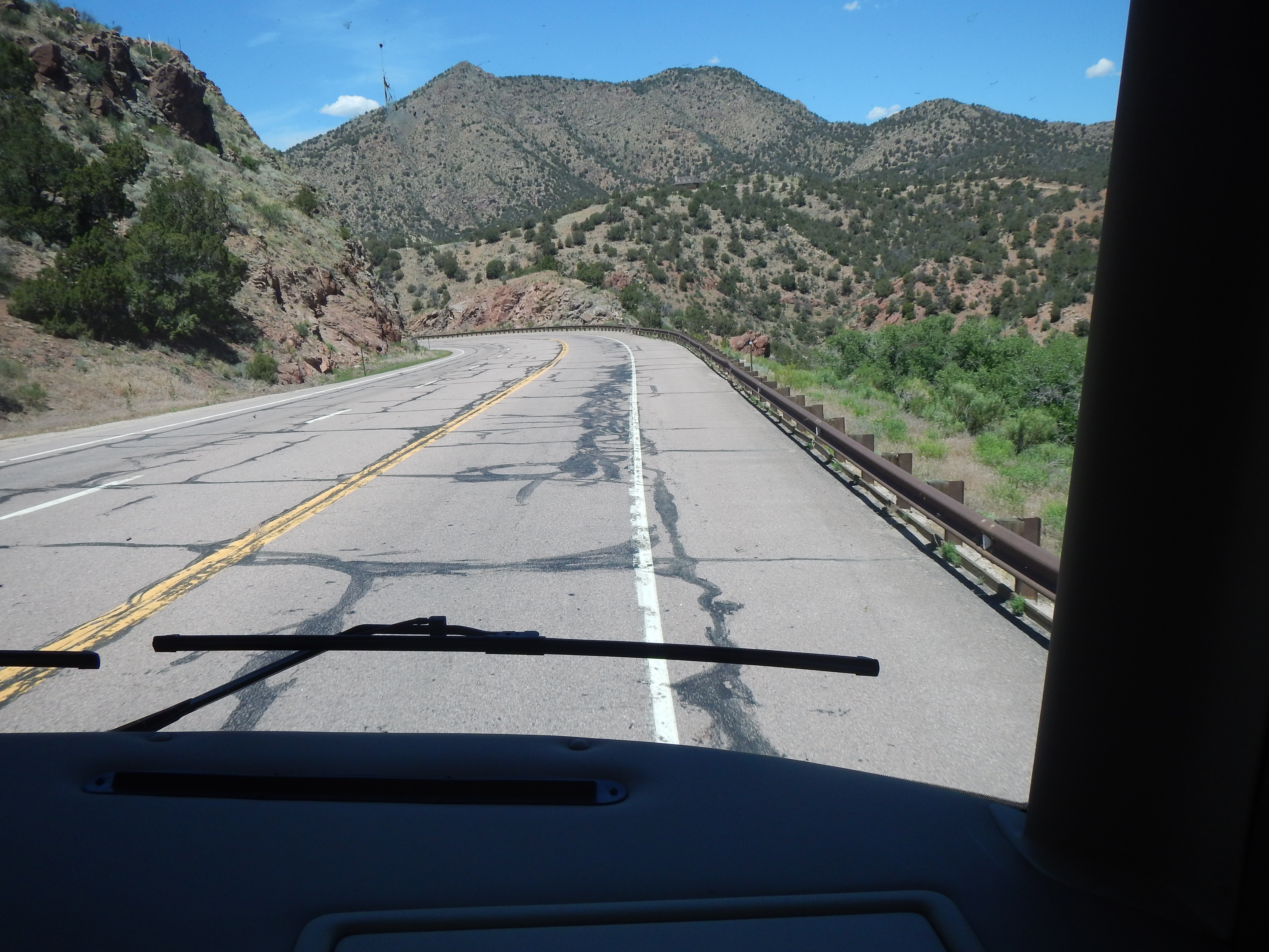
The next morning we knew we would have to cross the Sanger De Cristo Mountain range, just south of the Rockies, so we set off early (well early’ish for us, about 9am!).
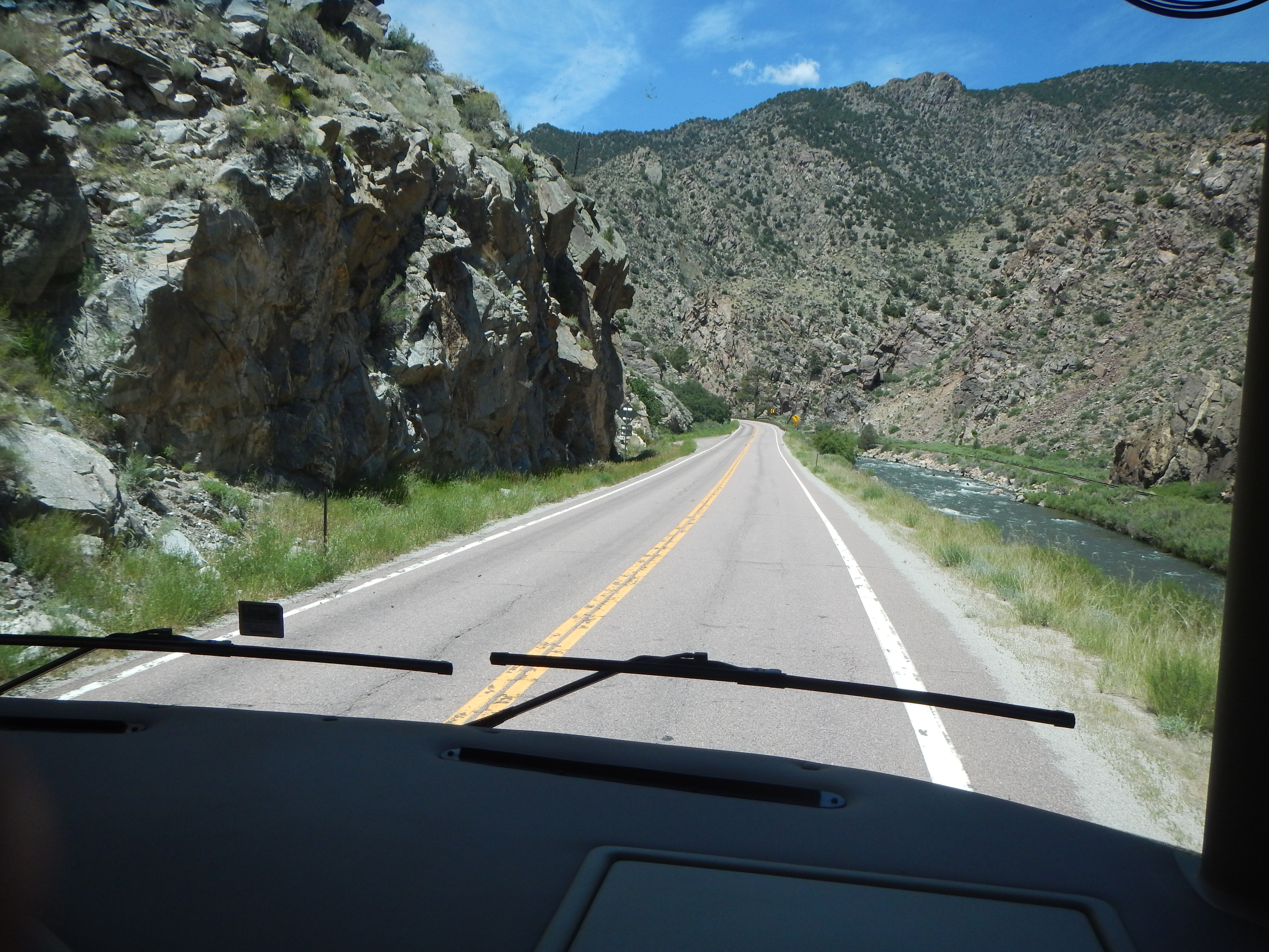
Right from the very beginning the road started to climb, steadily for the first 85 miles, then the rate of climb increased until eventually we were in the mountains proper.
The road twisted and turned, going higher and higher, with some of the turns really tight, the RV engine was working overtime, but all the ’in dash’ meters showed normal temperature
 .
. 
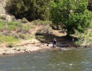
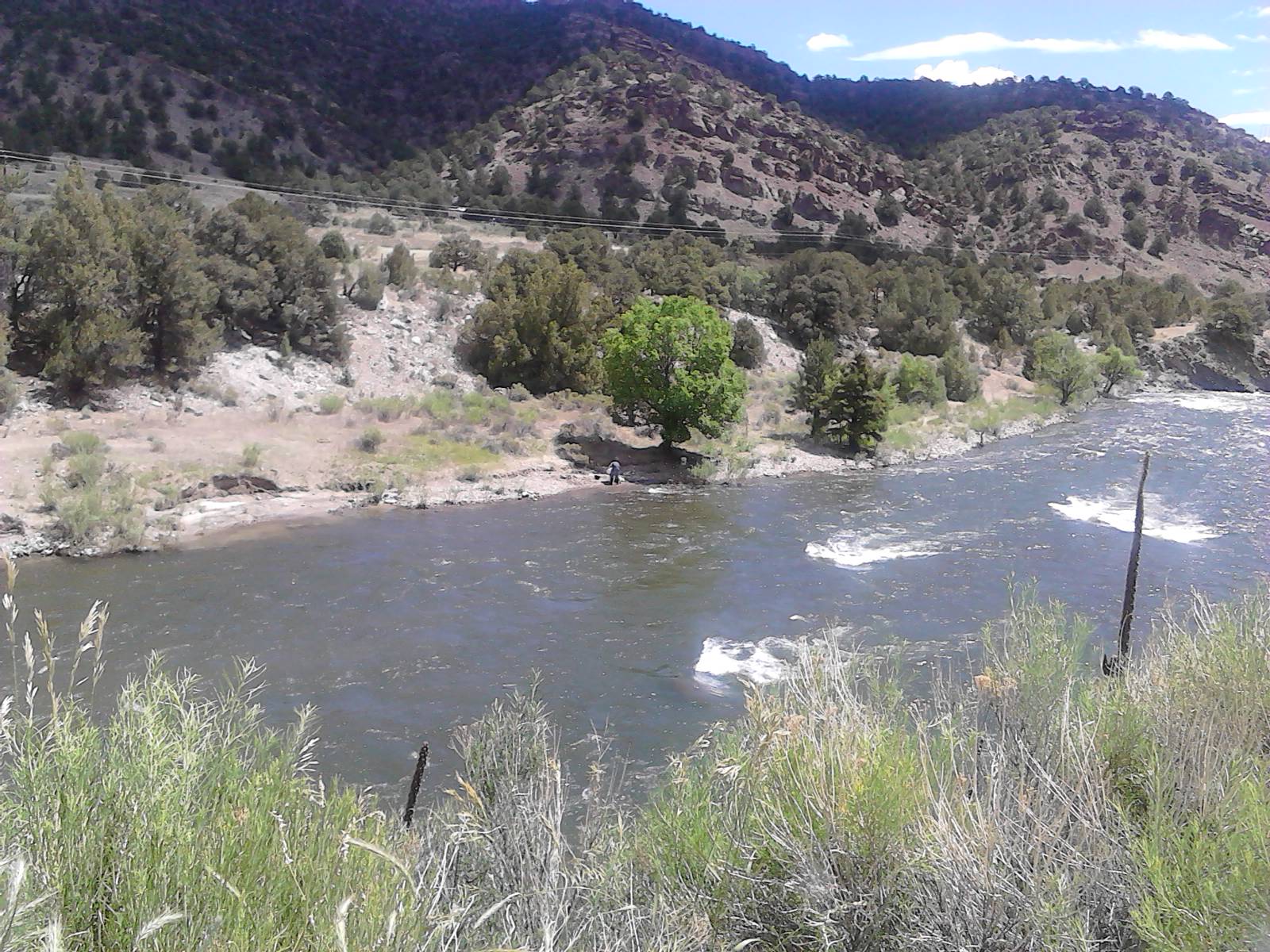
We even saw a guy panning for gold, apparently still a common occurrence in the Arkansas River
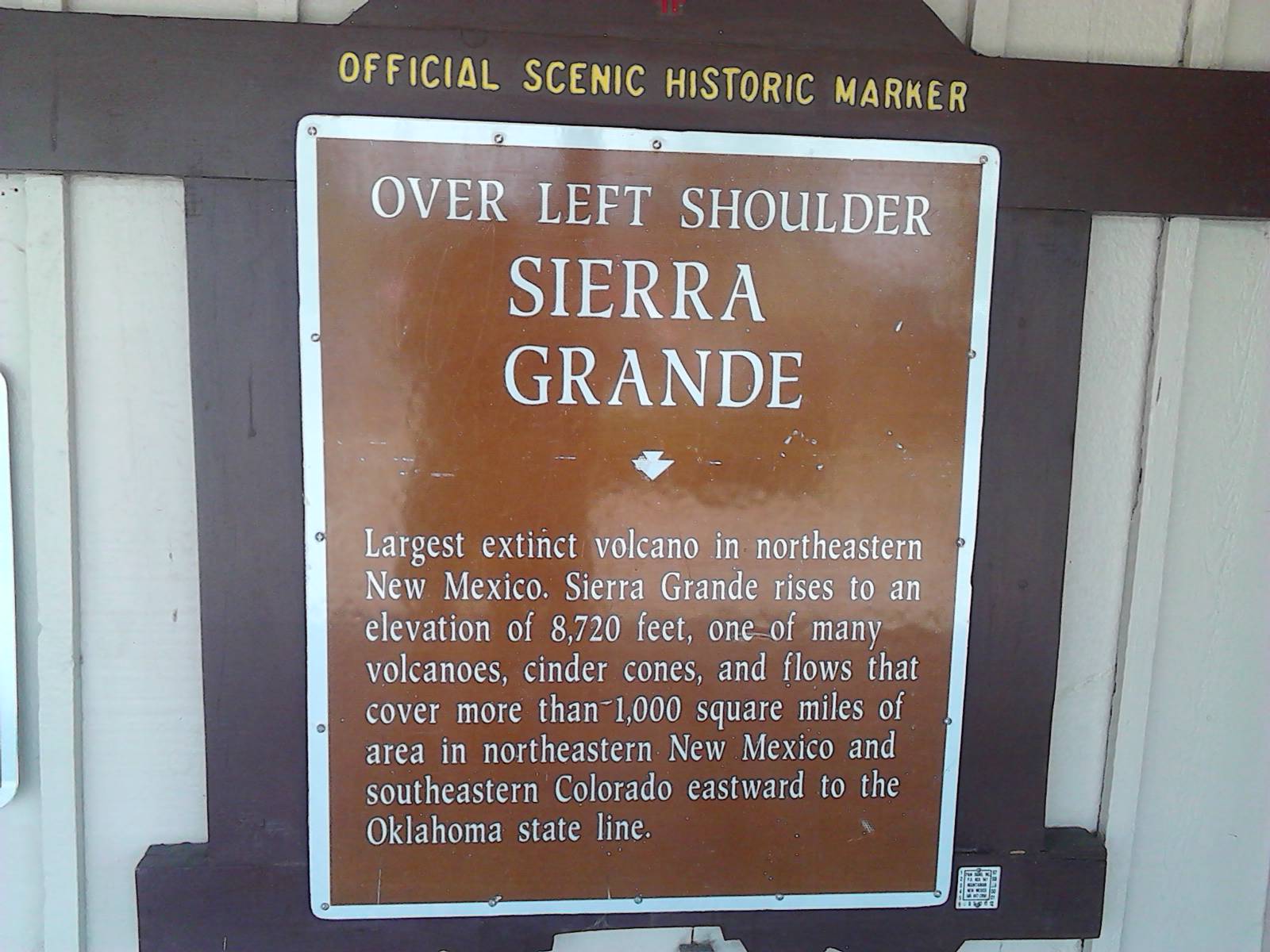
After some 120 miles or so we eventually reach the summit of Monarch Pass with the road topping out at 11,312 feet.
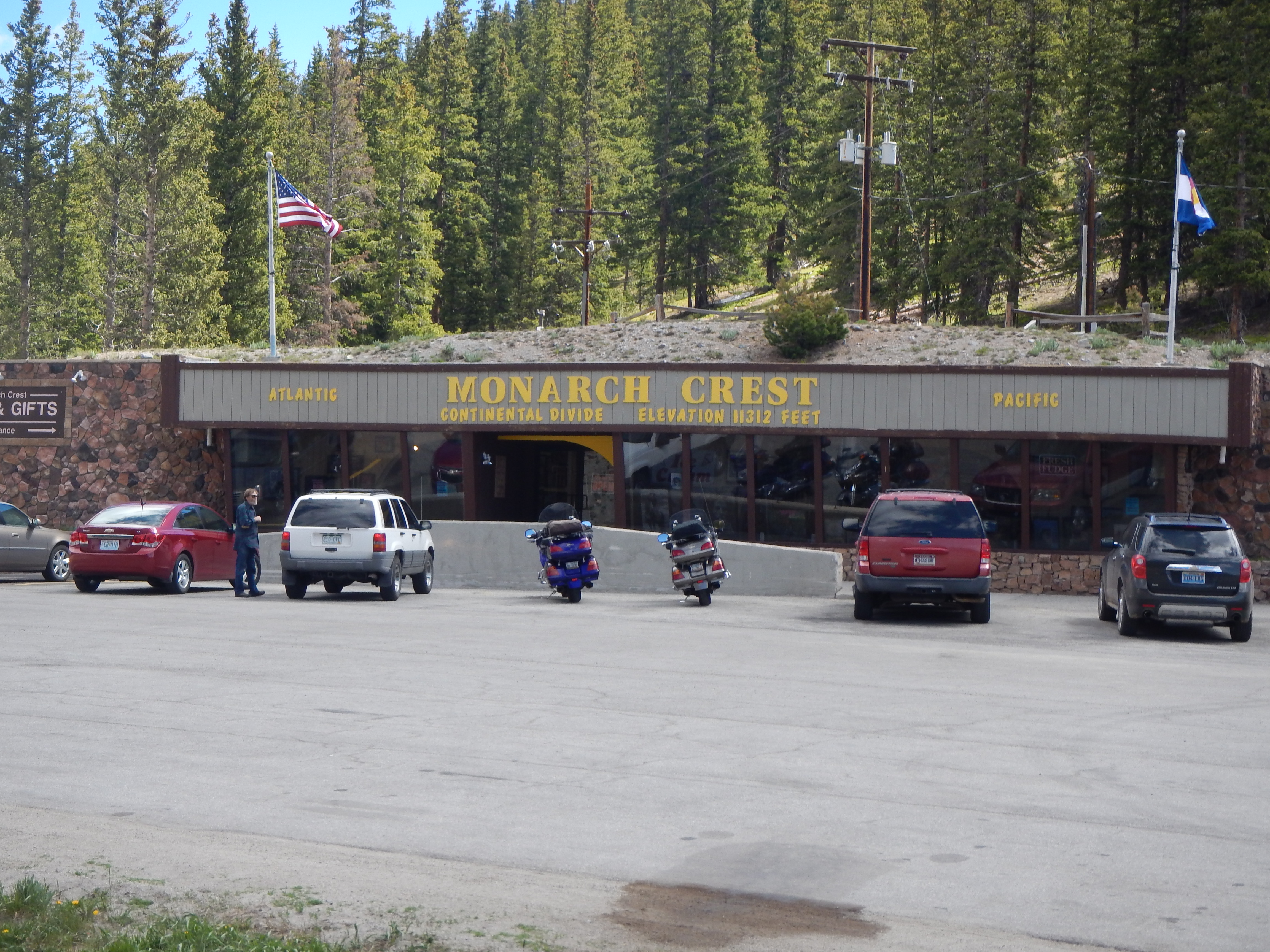
We stopped there to let both the RV and its passengers have a breather.
That was easier said than done and the air definitely felt ‘thin’.
This was the ‘Continental Divide’, where the waters flow either the Pacific or the Atlantic, depending which side of the pass they are.
See the snow covered mountains behind the RV below;

The journey down was a real rollercoaster!
With a repeat of the twists and turns we experienced climbing up, being reversed and experienced going down!
But once again the RV performed excellently, by diligent use of low gears and engine breaking and a few squeaks of ‘Mind the side’ and ‘Move over a bit’, we safely descended down the road to the lower elevations.
 .
. 
Lower elevations is a relative term, as when we finished for the day we were still at just over 6,000 feet.
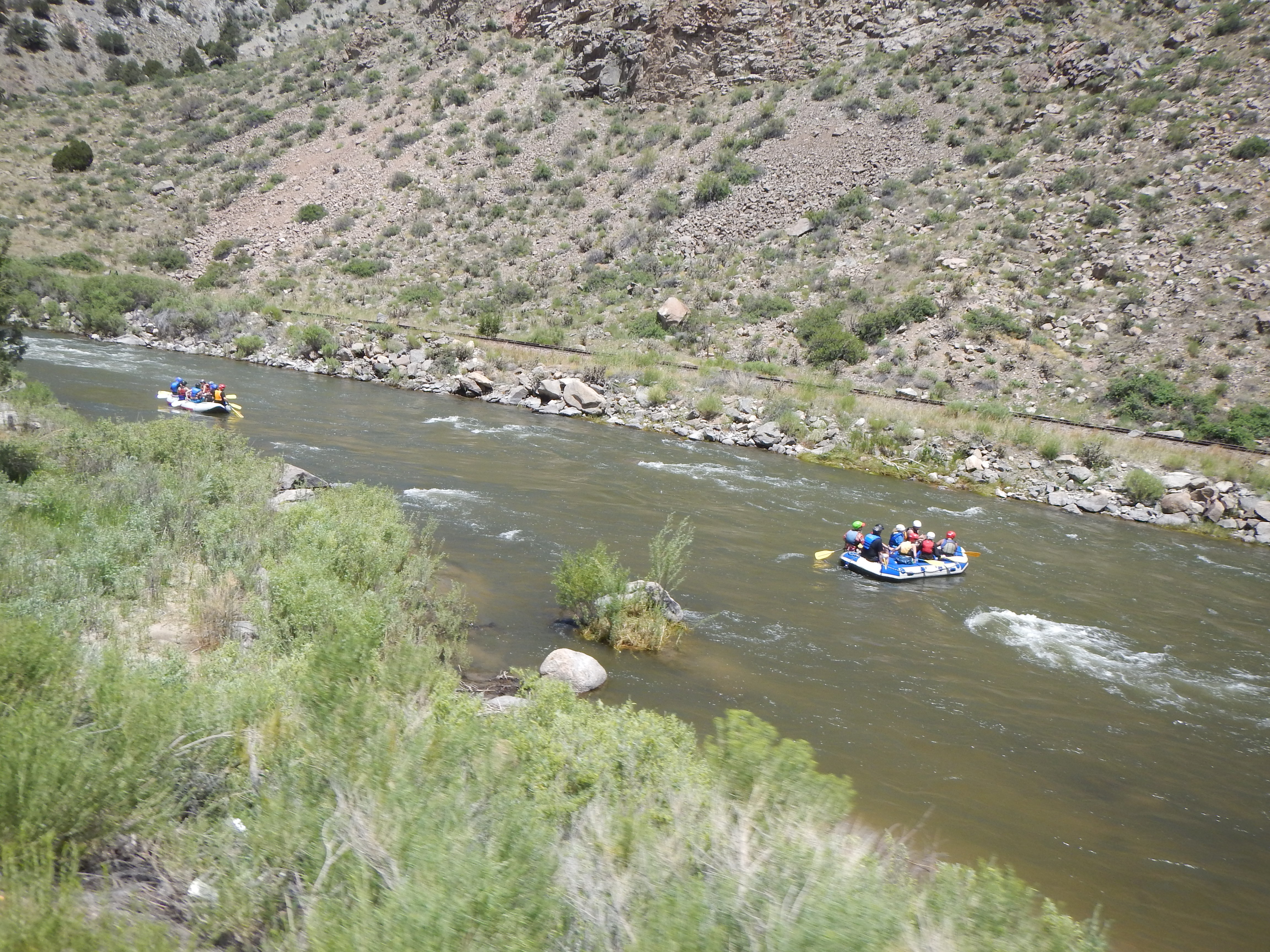
The trip along I-50 through Canyon City to Bighorn RV Park where we were staying was all alongside the Arkansas River, with loads and loads of White Water Rafting and Zipline rides, plus a smattering of Ski resorts.
 .
. 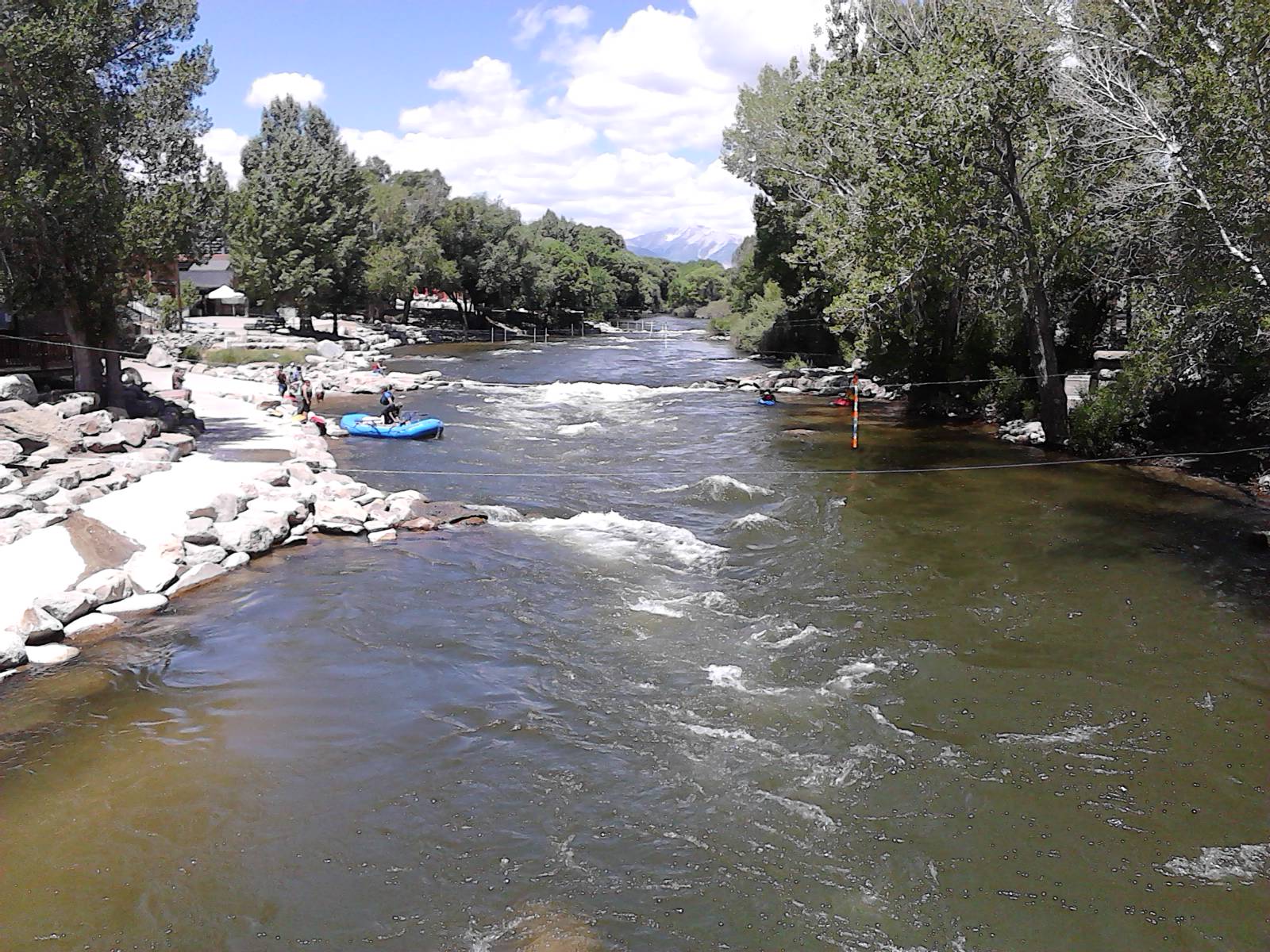
With high mountains to the front and back of us, the RV resort was picturesque indeed and directly behind our RV was a cliff with eagles soaring up and down it, catching the thermals, whilst below the cliff was the Arkansas River in full flow.
There were supposed to be Bighorn Sheep on the cliffs, but despite spending quite a long time, drinking beer and wine and watching, we didn’t see any.
But more on this in the next instalment!

Smashing….just smashing!!! I can’t believe that the Gatherer would actually accuse the Hunter of fabricating an antelope sighting….. It also sounds as though the “Nervous Nellie” passenger could use a calming pill whilst traversing the mountains of this beautiful country…rofl